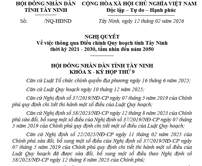
At the 9th Session (extraordinary session) of the 10th-term People’s Council of Tay Ninh Province, the council officially passed a Resolution on the Adjustment of Tay Ninh Provincial Planning for the 2021–2030 period, with a vision to 2050. The most notable highlight of this planning revision is the designation of the Duc Hoa – Hau Nghia urban cluster as the new political and administrative center of the province, marking a strong transformation in the spatial development structure following the provincial merger.
The 9th Session (extraordinary session) of the 10th-term People’s Council of Tay Ninh Province
The resolution was approved based on the proposal of the Provincial People’s Committee and the appraisal report of the Economic-Budget Committee of the Provincial People’s Council, in accordance with resolutions of the National Assembly and the National Assembly Standing Committee on the reorganization of provincial and commune-level administrative units. This is considered a strategic step to maximize the advantages brought by the merger and create new growth momentum for Tay Ninh Province in the coming period.
Duc Hoa – Hau Nghia: The new political – administrative center in a multi-center urban structure
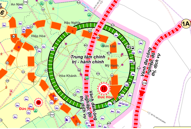
According to the approved planning content, the Duc Hoa – Hau Nghia urban cluster is identified as a new driving center to develop into the political and administrative center of the province. The political-administrative center will be located in the northern area of the Duc Hoa – Hau Nghia urban zone; the exact location will be studied in detail to ensure appropriate development space, strong technical infrastructure connectivity, interregional transportation links, and the long-term central role of the province.
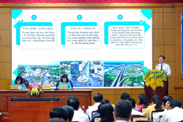
Planning of three major centers in Tay Ninh
However, selecting Duc Hoa – Hau Nghia is not merely a relocation of administrative headquarters. The planning establishes an urban development structure following a multi-center model consisting of three major hubs:
Tan Ninh – Long Hoa: Cultural, educational, sports, healthcare, tourism, and commercial center representing the identity of the Southeast region.
Long An – Tan An: Modern commercial and service center with high-tech industry and digital technology.
Duc Hoa – Hau Nghia: The new political – administrative center, also serving as a hub for finance, services, logistics, high-tech industries, and digital technology.
Within this structure, Duc Hoa – Hau Nghia is positioned not only as the administrative “headquarters” but also as a new growth pole of the province. This area lies within the southern dynamic urban chain, connected to Ho Chi Minh City Ring Road 3 and Ring Road 4 and regional economic corridors of Southeast Vietnam, while also serving as a satellite urban area sharing functions with the core area of Ho Chi Minh City.
The development orientation for this area follows an integrated urban – industrial – service model, representing a strategic step to shift the development axis toward areas with large land reserves, strong infrastructure connectivity, and long-term investment potential.
Ambitious socio-economic targets by 2030
The adjusted planning sets high growth targets:
Average GRDP growth 2026-2030: 10 – 10.5% per year.
GRDP per capita: 8,000 – 8,500 USD.
Industry – construction share: 55-56% of GRDP.
Digital economy: 30% of GRDP.
Urbanization rate: over 45%.
No households living below the national poverty line.
Development space will be organized under a framework of 3 socio-economic regions, 3 centers, 6 economic corridors, 3 growth axes and 1 border belt, ensuring balanced, sustainable development and stronger regional connectivity.
Infrastructure and urban development
The planning prioritizes synchronized development of major transport infrastructure such as Ho Chi Minh City Ring Road 4, the Ho Chi Minh City – Moc Bai Expressway, and the Ho Chi Minh City – Tay Ninh – Dong Thap Expressway, while also studying the extension of the urban railway system from Ho Chi Minh City to Tay Ninh.
The urban system will be clearly classified with 5 Grade-II cities (including Tan An, Tan Ninh, Hoa Thanh, Trang Bang, and Kien Tuong), along with plans to develop 4 additional Grade-II cities, including Duc Hoa, Ben Luc, Can Giuoc, and Can Duoc.
In terms of housing, the province aims to achieve 33 m² of housing floor area per capita, including approximately 5.4 million m² of social housing floor area with nearly 90,000 apartments.
Resolution approving the Adjustment of Tay Ninh Provincial Planning for the 2021 – 2030 period, vision to 2050.
Long-term significance
The official approval of Duc Hoa – Hau Nghia as the political and administrative center marks a turning point in the development history of the new Tay Ninh Province. This is not only a shift in administrative management space but also a restructuring of the entire urban and economic development axis of the province in the context of the merger.
From a satellite urban area, Duc Hoa – Hau Nghia is now positioned as a central hub for coordinating development, connecting regions, and leading growth. If implemented synchronously according to the planning, this area will become a new nucleus on the development map west of Ho Chi Minh City.
The resolution takes effect immediately from the date of approval. The Provincial People’s Committee is assigned to finalize documentation, organize implementation, and publish detailed planning as soon as possible.
Source: CafeLand

 31 month 12, 2025